Day 1: Proposed Project

They’re more of the subtle things that belong to a novel rather than to art history.

Leo Castelli to Paul Cummings

In December 1970, art dealer Leo Castelli slyly redirected an interview with Paul Cummings for the Archives of American Art.  They were discussing Castelli’s work as a successful dealer and gallery owner.

Leo Castelli (1907-1999)  established the Leo Castelli Gallery in 1957 in New York City, recognizing that important cultural changes were occurring in America and that a new form of art would derive from Abstract Expressionism which was in its heyday. The first two artists he signed up were Jasper Johns and Robert Rauschenberg, both transitional figures in the move from Abstract Expressionism to Pop Art. Castelli became known as one of the greatest salesmen in the art market and an avid supporter of contemporary art movement. This digital project features transcripts and audio excerpts of interviews with Castelli and his contemporaries.

Source: Day 1: Proposed Project

Project Proposal for DAH: Mapping the Dynamic Landscape of Architectural Practice

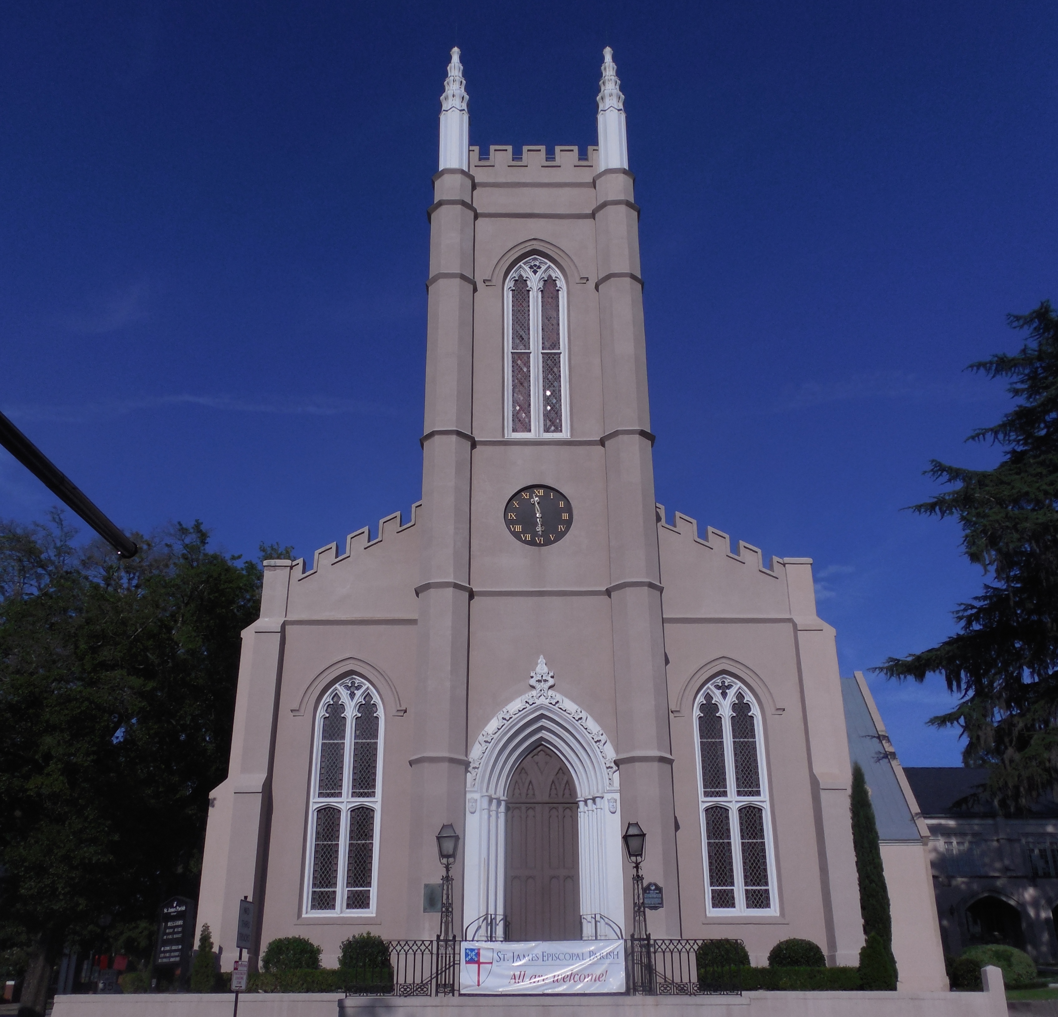
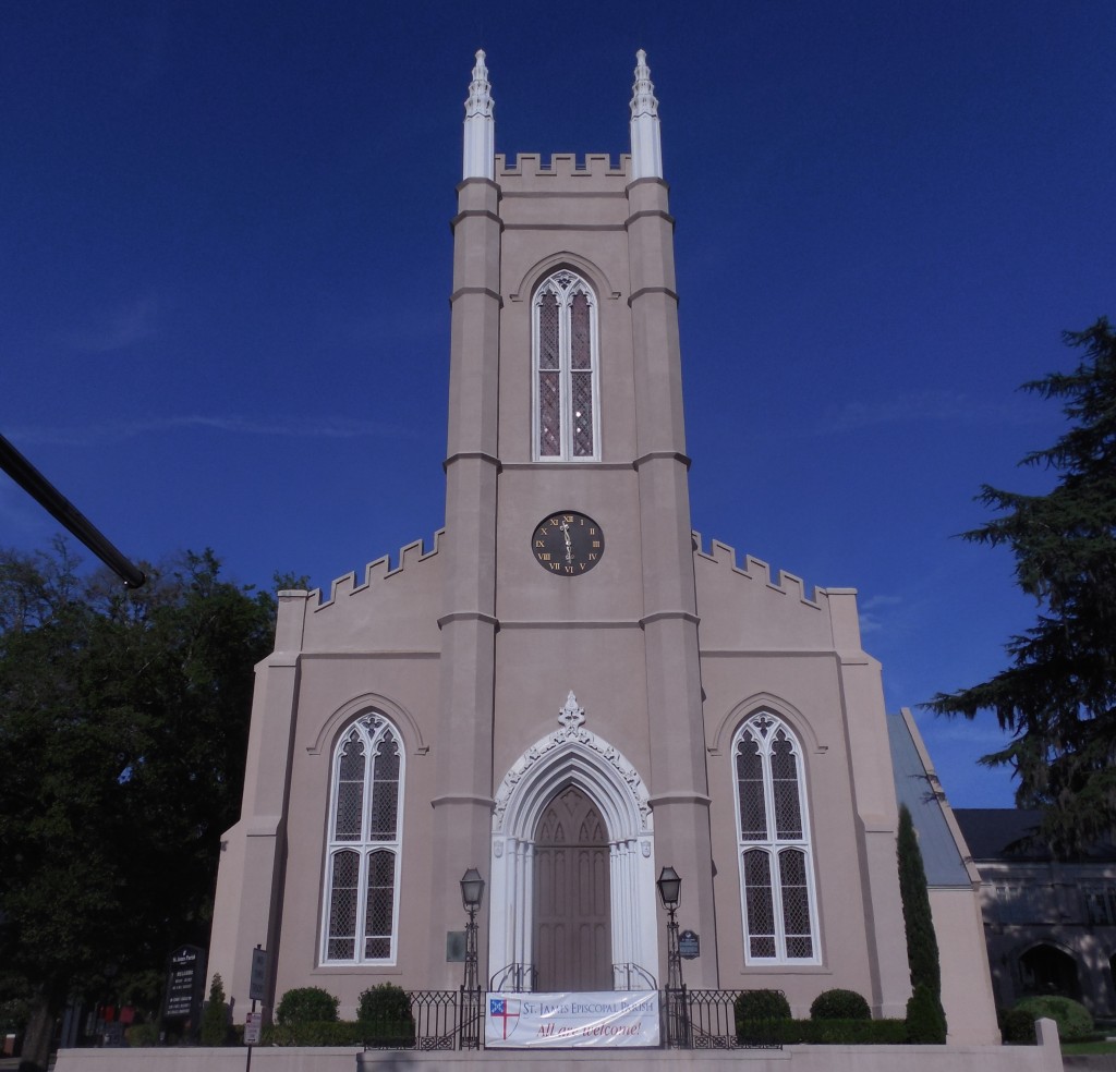
St. Jame's Church (Wilmington NC: 1839)

St. James’ Episcopal Church (Wilmington NC: 1839)

During the first half of the nineteenth century, Americans built extensive networks of transportation that scored the land with hundreds of miles of canals, roads and railroad tracks. As these physical emblems of technological development connected established cities with new towns and growing hubs of industrial development, other technological webs, including federal post roads and the services of private delivery businesses, added a second layer of communication throughout the states.

This dynamic landscape was recognized as a distinguishing characteristic of modern life by the country’s first self-proclaimed professional architects, who pursued avenues to practice that were more broad-reaching than those of any previous generation.  Much less geographically bound than their Colonial forebears, nineteenth-century architects expanded their client base, entered competitions, made use of newspapers and communicated across state lines with clients and builders they would never meet, completing buildings that they would never see. Even so, the growing rail network still imposed certain nodes of concentration and areas of disconnection that are invisible to later travelers.  The spatial reality of antebellum America influenced the early professionals and the ways they pursued jobs and practiced architecture.

This project proposes to research this dynamic landscape through the case study of Thomas U. Walter (1804-87). Walter provides a significant model as one of the country’s most active architects in this period: designer of hundreds of projects in several states (and also China and Venezuela), including prominent works in Philadelphia (Girard College) and Washington (additions to the Capitol). Walter used virtually every imaginable kind of conveyance, from horse-drawn wagons and steamboats to trains and sleighs, as well as post and parcel delivery services, in order to visit and communicate with clients and builders, oversee construction, observe quarries and foundries, and socialize with professional peers (especially as a co-founder of the American Institute of Architects); twice these travels took him overseas (Europe in 1838, Venezuela in 1841). Walter noted the details of his travel in office notebooks and journals, which not only record his movements but also his lively commentary on various means of conveyance.

This project will not only illuminate Walter’s practice but also contribute to an understanding of the problem of technological determinism in seeking the extent to which modes of conveyance (of people, materials and information) influenced the way architectural practice developed as it did—either as a determining, influencing, or coincidental relationship (or potentially all three).  Mapping technology might identify the temporal interplay between materials suppliers (quarries, foundries) and the means by which they were shipped to Philadelphia (canal, rail, road) on one well-documented project like Girard College, or the dependence on communication technologies for a small group of marble buildings that Walter designed in the early 1830s. Another option would consider the determining factors for Walter’s approach to projects that he carried out either through personal travel, complete dependence on mail, or a combination of the strategies, through decades of his career.

Source: Project Proposal for DAH: Mapping the Dynamic Landscape of Architectural Practice
Ongoing DH Project

Experimental, amusing, or beautiful, artist books are art in book form. Four years ago, we began collecting artist books for teaching and research. This non-browsing collection varies in structure, technique, and content. Our books have been used by students, faculty, and museum professionals.

Although artist books are tactile experiences, they are hidden in Special Collections for preservation and can be difficult to access through the library catalog. In order to increase accessibility, we have begun the digitization process for over 300 works. The first phase of the project will focus the 50 books by local and regional artists.

This new enhanced digital collection will include multiple images of a book. In addition, we are conducting artist interviews and creating videos to demonstrate the “reading” of an artist book which will be especially valuable for sculptural books. A unique addition is GIS mapping which is beneficial since the collection includes several items by local/regional artists. Mapping also demonstrates the relationships and collaborations between the book artists.

Behind the scenes, we are establishing metadata guidelines to improve the organization of information and accessibility. Part of this process is to create meaningful records by describing books in more detail (e.g. structure, materials). In conjunction with VRA Core, our content standards create a consistent, functional research tool. Starting with LUNA Imaging software as our digital platform, we will showcase images, audio, and video. This information will then be placed in ARTstor’s Shared Shelf to increase visibility.

BottomOfTower
FullTower
TopOfTower
BabyShoe_TitlePage
LadyHeel_colophon
apron
glove_with_text
hankerchief
pages_example1

Adapted from presentation abstract for Visual Resources and Digital Humanities (VRAlocal: Nashville 2014)

Source: Ongoing DH Project

My Project

Question: What is a man [sic] walking down the road?

Answer: Time.

—traditional Maya riddle

This riddle concerns esoteric knowledge, not humor. It also exemplifies the fused space-time continuum in Maya thought and explicates how to understand the physical and metaphysical worlds. Space, buildings, and imagery were integrated into Maya civic-ceremonial centers—the loci of political theater and Becoming (in a Deleuzian sense)—and hence cannot be understood as discrete entities or images. Moreover, in Yucatan, Mexico, causeways and colonnades suggested ideal traffic flow and created panoramic views. The famous capital of Chichén Itzá (ca. 800-1150) features spatial-pictorial tableaux composed of pillars whose four vertical faces are carved with distinct individuals and which collectively formed panoramas that would have shifted according to position and movement. I will attempt to recreate some of these so-called paths of perception from in situ remains, archival photographs, and mapping technology. Rather than creating flashy fly-throughs that are akin to video games, my goal is to create walk-throughs of what people at Chichén plausibly saw. This would be an initial step in coming to terms with aesthetics, vision, and flexible three-dimensional visual-spatial experiences, in essence the unique flavor of Chichén visual culture. The results might further an understanding of embodiment, habitus, and place-memory, all of which involve dynamic rather than static experiential realms.

Source: My Project

Project

My project The Art of Imitation: Renaissance Ceramics in the style of Ming Porcelain examines the practice of imitating porcelain in Italian Renaissance pottery workshops and the reception of these imitations. Due to a growing appreciation of rare, imported porcelain, early sixteenth-century Italian potters appropriated and developed techniques of covering their brownish-red earthenware vessels in white, tin-glazes, followed by the addition of blue decoration. These imitations lacked the technical refinement of light, kaolinite vessels from China, but the outward appearance satisfied aesthetic demands. For this project I would like to explore the possibilities of spatial history and mapping in order to demonstrate trade patterns of true porcelain. I would also like to create visualizations of data related to existing inventories of ceramics in the Renaissance.

Blue and White Dish with Merchant Ship. Tin-glazed earthenware. Cafaggiolo. c. 1510.Blue and White Dish with Merchant Ship. Tin-glazed earthenware. Cafaggiolo. c. 1510.


Source: Project

My project(s)

Andy helping David explain his game.


I am on a digital humanities tear this summer, and I started by attending the Digital Humanities Summer Institute at the University of Victoria; my course was on games and particularly on digital games.  I signed up for the class thinking that I would produce a digital game for my students in the interdisciplinary humanities course and/or the art history survey.  My group did come up with a digital interactive library game called, I think, Zombies in the Library; Zombies are students who do nothing but sleep in the library. And I learned a lot during the week and brainstormed some great stuff including the idea of using rubrics as a form of game playing, but the biggest thing I learned was to temper my expectations.

Which is a long way of saying that my project(s) for this seminar may or may not be realistic. One of the projects for my summer and fall is to produce four digital interactive modules for my students. And I thought I would start that process of development here both by listening to what others are doing and by viewing some of the modules already published. The Art History Teaching Resources site looks to be very helpful in this regard. I am sorry that I had to miss the Games + Learning + Society conference at University of Wisconsin Madison and the pre-conference play with ARIS, but I intend to go next year, since I am also interested in writing a module for my Language and Landscape course for students to develop their own map of local, sustainable gardens in the Chicago area and another map on the language distribution across Chicago. (The two are not disparate; one of the assignments is for the students to collect the names of the plants in their garden and compare / contrast the language used by other gardeners.)

Another project on the radar is the e-portfolio, particularly as it might represent students’ work across their full time at Wright College and the way it might demonstrate achievements in certain general education competencies, such as writing, close reading, technological literacy. I have students use a collaborative wiki site for each class, and students that I teach at DePaul have access to individual e-portfolios, but Wright has nothing at this point close to an e-portfolio. And even my DePaul students don’t use it in the most robust way: they rarely show the growth, for instance, in their conceptualization and demonstration of critical thinking through writing, but instead just post their “best” papers.

Yet, I also have to think about the resources available at my institution and for my institution and for my students and for me. The administration has suggested applying for various grants, and that too is something I’d like to explore during this seminar, particularly start-up monies for small projects with collaboration across institutions and disciplines. But, again, my institution doesn’t really have much real experience in this regard, and we all may need to rein in our desires.

Source: My project(s)

Getting Ready to Rebuild that Portfolio

The Rebuilding the Portfolio team is busy preparing for the arrival of our cohort that includes 22 art historians, librarians, and museum professionals. Our schedule is now available with readings for the institute, while we continue to refine the daily activities and resources. Feel free to follow along with our progress in July.

We are excited to be working together in one of Mason’s active learning classrooms. Institute Co-Director, Sharon Leon, is a member of the inaugural faculty team working in this new classroom environment and assessing how learning spaces influence pedagogy. If you wish to learn more about the teaching and learning experiences of faculty and students in the past academic year, watch this short video .

Applications Open

Join us July 7-18, 2014 for Rebuilding the Portfolio: DH for Art Historians, a summer institute at the Roy Rosenzweig Center for History in New Media, George Mason University, supported by the Getty Foundation.

Rebuilding the Portfolio: DH for Art Historians is designed for 20 art historians, from different stages of their careers and from varied backgrounds, including faculty, curators, art librarians, and archivists who are eager to explore the digital turn in the humanities.

We seek applications from individuals who have had very limited or no training in using digital methods and tools, or in computing.

Take a peek at our proposed schedule, and apply today. Applications will be open until March 15, 2014.